Monday, August 9, 2010

Sunday, August 8, 2010

Salmo Loop Day!  Today started out very, very rainy.  Nonetheless, four hardy hikers joined me for today's big hike on the Salmo Loop!  We dropped into the Salmo Basin, crossed the Salmo River, did the side hike to the Salmo Cabin (and met the WTA crew camped there), crossed into Idaho and continued up to the Shedroof Divide, ate lunch at the Little Snowy Top Lookout, and then completed the Divide Trail to the Salmo Divide and back to the car.  We were done by 5pm!  Fortunately, the rain finally stopped a little while before we reached the Shedroof Divide, but unfortunately, the clouds never lifted enough to reveal the views of the surrounding mountains. 
At Little Snowy Top Lookout
View from the summit of Little Snowy Top--normally one can see Snowy Top (BIG Snowy Top!), Canada, and the Idaho Selkirks from this spot.  Today--clouds & more clouds.
The group on the Shedroof Divide Trail
Lorna had a Monet umbrella.  :)
Group picture at the end trailhead.

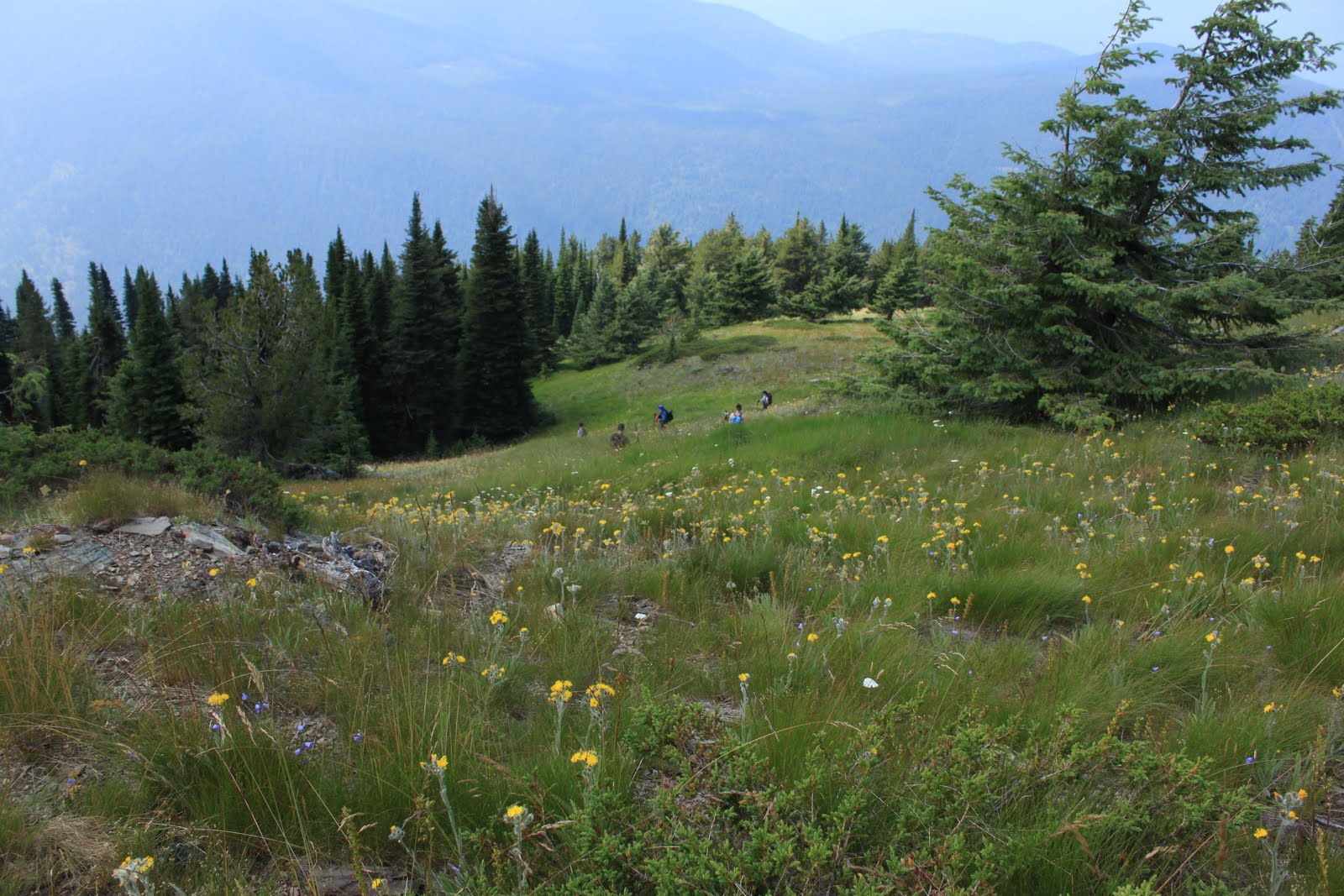
The wildflowers were fantastic, and I found myself walking well behind the rest of the group on the Divide as I took pictures. 

It was a cold, wet hike, but well worth it!  Maybe I'll try it again later in the month so that I can get pictures of the mountains, too!  :)
My WTA trip report can be found here.

Today's mileage = 21.5 miles
Grand total for the month =113.12 miles

Saturday, August 7, 2010

Today I led a group hike up Hall Mountain from the Noisy Creek Trailhead. 

This trail has been my nemesis for years--today was only my second time on the top despite starting the hike eight or nine times over the past ten years or so.  Fortunately, none of the problems from earlier trips happened on this one!  The summit is spectacular, especially right now with all of the wildflowers in full bloom. 
One of my favorite things about this trail--a strong hiker can walk to the Inland Temperate Rainforest from here, but on Hall Mountain one can find sagebrush growing among all of the wildflowers.
Sullivan Lake far below
Hikers making the switchback

Trails = Noisy Creek #588, 5.3 miles each way + Hall Mountain #540, 1.8 miles each way.
Read my WTA trip report here.
Today's mileage = 14.2 miles
Grand total for the month = 91.62 miles

Friday, August 6, 2010

I have a map of the Salmo Priest Wilderness, and I keep track of all the trails I have hiked within the wilderness by highlighting the trails as I complete them.  At this point there are only a few trails that are not highlighted, and today I added one more trail to my list of completed hikes in this area.  The trail I needed and the starting point for today's hike was the Slate Creek Trail (#525).  It is 4.2 miles long and intersects the North Fork Trail (#507) which leads up to Crowell Ridge in 2.7 miles (Crowell Ridge #515).  I nearly made it to the end of Crowell Ridge (3.7 to Bear Pasture or 2.2 to the end of the ridge), but I reached my turnaround time just 1/2 mile shy of the end of the ridge before it drops down to Bear Pasture.  I was considering hiking a little longer when I started to hear thunder in the distance--that made my decision for me!  The rain caught me in the last four miles of the hike and I walked out in rain, lightening and thunder.  It was a little scary, and I wasn't able to hike as fast as I would have liked because of the downfall on the trail.  The good news is that there are no downed trees on the North Fork Trail--I helped with a trail clearing crew on that trail during Hike-a-Thon last year, so it was nice to see that the trail is still clear.  Now I want to see if I can get some friends to help clear the Slate Creek Trail, too.
Salmo Priest Wilderness!  My FAVORITE place!
Crowell Ridge Trail
Abercrombie & Hooknose Mountains as seen from Crowell Ridge
Crowell Ridge
Sullivan Mountain Lookout in the distance--there is a trailhead there, but it is a very rough road to get to it!
Wildlife!

Read my WTA trip report here.

Today's mileage = 17.2 miles
Grand total for the month = 77.42 miles

Thursday, August 5, 2010

This was the weekend for the Mountaineers' summer outing at the Noisy Creek campground on Sullivan Lake.  I made plans to leave town on Thursday so I could get in some extra miles before the group hikes I planned to lead on Saturday and Sunday.  I got a late start, so I didn't have time to get in the mileage I had originally planned for today.  I wanted to hike in the Little Pend O'Reille Wildlife Refuge; I'll have to save that one for a later date.  Instead I drove directly to Sullivan Lake and hiked the Elk Creek Falls Trail (#560), the Mill Pond Trail (#550), and the Mill Pond Flume Trail (#520).
Elk Creek Falls
Indian Pipes
Today's mileage = 3.36 miles
Grand total for the month = 60.22 miles

Wednesday, August 4, 2010

Iller Creek

Today I went to the school and was able to do some xc work while the girls were out running.  A couple of the girls used the whirlpool after their run & I joined them--my knees were swollen this morning, and then the calf still hurts.  After that I went up to Iller Creek for a hike.  I hardly ever hike up there; instead I like to use the trail system up there to get in a quick trail run after work during the school year.  The lower section of the trail is in great shape--this is one of the trails I have worked on with the WTA.  In fact, there are two sections of the trail that I consider "my sections" because I helped to build them.  Iller Creek also made the cut for this month's Backpacker magazine.  I was even quoted!  The trail is not as spectacular as my usual haunts, but I love how close it is.  I think it takes me less than ten minutes to get there from the school.
View from Big Rock
Trailhead kiosk
Today's mileage = 5.5
Grand total for the month = 56.86

Tuesday, August 3, 2010

Update!

This afternoon I went up to the Mount Spokane Nordic Area for an afternoon run/hike.  My calf survived the Cake Walk without so much as a twinge, so I thought perhaps I was ready to run again.  I decided to play it safe by running the trails out to junction one and back, and at nine minutes and thirty-five seconds (approximately how long I managed last time, too) my calf tightened up again.  Ugh.  I sooooo want to run right now--especially since I arrived home to a phone message that there is space for me in this year's Cutthroat Classic.  I have been on a waiting list since June, I can now get in...but I know I shouldn't.  If I can't make it to ten minutes tonight, how can I make it eleven miles in a few weeks?  Sigh.

I'm getting ahead of myself, though.  I didn't stop at ten minutes tonight--instead I grabbed my backpack and started hiking out around Shadow Mountain.  I knew that there would be huckleberries out there, and I hung out on the flank of the mountain for a couple hours in order to pick them.

The trails: (RUN) Valley View to Bear Grass to Brian's Hill.  (HIKE) Bear Grass to the car, then back on Bear Grass to Sam's Swoop to Eagle Crest to Shady Way to the Shadow Mountain Loop to Wild Moose to Hemlock to Blue Jay to Bear Grass.  (12.6K)

Grand total for the day = 7.81 miles; grand total for the month = 51.36 miles

Cake Walk 2010, August 1, 2010

This is the best possible way to kick off my Hike-a-Thon campaign--43.55 miles on the Kettle Crest Trail!

We set our shuttle Saturday night, camped at the White Mountain TH, survived the late-night thunderstorm, and hit the trail at 5:38am on Sunday morning.
My marker of authenticity at the southernmost point on the Kettle Crest Trail.
The wildflower displays were fantastic this year.  Normally the flowers would be gone by now, but with the cool spring and lingering snow in the high country, now is the optimal time for flower viewing.
Near White Mountain
Near White Mountain
 We also found that the rain that fell at the trailhead was hail on the ridge.  It looked as though it had snowed.
Between White Mountain and Barnaby Buttes
More wildflowers.
I noticed the following sign at Sherman Pass.  I'll use this for my "English Wall of Shame" at school, but in a way the sign is fitting.  We had just finished the 13.31-mile southern portion of the trail, and the "trial" was about to begin--the northern section is 30.24 miles.
At the "trialhead"
I arrived at the pass at approximately 10AM (so I was only twelve hours from finishing my hike!).
the description of where we had been
the description of where we were going
From the pass it was time to start climbing--the high point of this route is Copper Butte, elevation 7,140'.  It's the sixth highest mountain in Eastern Washington.  The wildflowers were fantastic at the top.
Near Wapaloosie Mountain
Indian paintbrush smiley face?
The wildflowers on Copper Butte
This is also an area that has been shaped by wildfire--the most recent near Copper Butte was 1994.  The standing snags are stunning.
Snags between Lambert & Midnight Mountains
The live trees are also spectacular.


The standing snags that were not killed by fire are covered with moss:
In the late evening a thunderstorm moved in; we spent the last hour or so walking through the storm and rain-showers.  I finished just after 10pm, so it was 16.5 hours of walking to complete this 43.55 mile day-hike--my biggest day-hike ever!