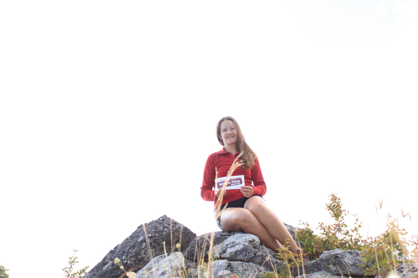
Sunday, August 22, 2010

Saturday, August 21, 2010

So I'll admit it, the sign at the trailhead freaked me out a little bit.  I slept in the car Friday night; I never sleep in the car!  I noticed a note someone left in the trailhead register at the North Fork trail this morning; the person who left it made some very good points about how the forest service needs to post a little more information about the cougar "encounter."  I agree wholeheartedly.  If the sign had said cougar "sighting" I would have understood and probably not been so scared; "recent encounter" seems like a totally different situation, and I wanted to know how recent and what happened.  At any rate, I slept very well inside the car, and I didn't have any encounter of my own.

Today Jeff met me at the trailhead and we hiked the North Fork Silver Creek trail up to the summit of Abercrombie Mountain.  Abercrombie is the second tallest peak in Eastern Washington; Gypsy Peak beats it out by one foot.  I have only hiked Abercrombie once before, and when I last did it I used the other trailhead.  This hike is much longer, and I think I like it better besides!  It would make it difficult to do the Abercrombie/Hooknose combo hike from this trailhead (there is no trail to Hooknose, although there is an obvious route--about 2 miles each way).

The best aspect of this hike is the forest.  The trail is completely different from the South Fork Trail even though they start only a few hundred feet apart.  This trail is almost completely dry (only two very small water sources in 7.7 miles).  There are portions of the trail that are thickly treed, but there are also sections of amazing ponderosa pines that must be hundreds of years old.  Additionally, there is a large section of aspen trees, and some of them are huge!  Near the intersection with the Abercrombie trail there is a section of open meadow with a few giant, moss-covered old trees.  The meadow has a few wildflowers left; I'm sure it was spectacular a couple of weeks ago.  There are also sagebrush plants up there--I love seeing sagebrush up above 6,000'!
Aspen grove in b&w
Another view of the aspen grove.  I want to come back in October to see what this looks like at that time!
Our first view of Abercrombie
Trail intersection.  Apparently someone had a lot of nails left over and wasn't sure what else to do with them.
Pretty butterfly!  I've never seen a brown one of these before.
At the summit of Abercrombie.
The aspen grove on our way back down.
I saw this on my way home.  Too funny--plastic kid chained to a garbage can.  Child abuse?  I think so.

Read my trip report here.

Today's Mileage = 15.4 miles
August Total Mileage = 232.55 miles

Friday, August 20, 2010

Today I drove up to the North & South Fork Silver Creek Trailheads and campground to go for a hike and camp.  The first thing I noticed when I arrived was a sign that said there was a recent cougar "encounter" in the area.  Encounter, not sighting.  I don't get scared about most wild animals, but I do get scared about cougars.  I kept my pepper spray handy the whole time I was there.  I also brought my Pulaski along so that I could sharpen the adz-end before Sunday's trailwork; I carried it with me when I hiked to the outhouse.  I'm sure I was overreacting, but we all have phobias, right?

I got a late start (again!) and then made a few stops enroute, so when I arrived at the trailhead it was already 2pm and I was starving (here lately, I'm always starving).  I made myself lunch and looked at my maps and guidebooks and finally settled on the South Fork Silver Creek trail to Gunsight Pass.  It's seven miles each way, so I knew that I'd have to fly in order to make it to the pass and back before dark.

The trail really surprised me.  Things are typically pretty dry in this area, but this trail has reliable water sources the entire way to the pass.  The first two stream crossings were almost enough to make me take my shoes off and wade across, but I made it by hopping on rocks instead.  I wished that I had gotten an earlier start so that I could have soaked in the streams when I was done hiking...my legs were killing me by the time I got back.

I was also wishing I had gotten an earlier start when I arrived at Gunsight Pass and saw the size of the huckleberries up there.  They were amazing!  I also spooked a bull moose in the last 1/4 mile of the hike to the pass--he ran off so quickly that I didn't have time to get the camera out.

The views along this trail are not great until one is really far up the trail, so I decided that my favorite feature of the trail (aside from the huckleberries) were the giant larch trees.  This would be worth another hike up in October to see the changing colors.  Next time I'm going to get an earlier start so that I can include the scramble up Linton and Sherlock.

My stats for today:  hike up = 3 hours; hike back = 2.5 hours (including snacking time); TH @ 3,230' & Gunsight Pass at 5,600'; trailside snacks = huckleberry & thimbleberry.

Read my WTA trip report here.

Today's mileage = 14 miles
August total mileage = 217.15 miles

Thursday, August 19, 2010

Short mileage day

Today I only had time for a morning run with the team.  I met the girls at the trailhead and did part of the run with them; I did three miles of their five mile run.  I can't find my Dishman Hills trailmap, so for now I'll call it what the girls do: Northwest Passage.  I'll have to update this once I find my map!

Today's mileage: 3 miles
August mileage total: 203.15 miles

Wednesday, August 18, 2010

Back to the Salmo Loop--Backwards!

Today was a beautiful, sunny day in the Salmo Priest Wilderness!  Three of us hiked the loop today, and because I didn't want to do the exact same route as a week & a half ago, we did the exact same loop in the opposite direction.  The added advantage was that we finished the exposed Shedroof Divide section before it got too hot.  We saw two backpackers, too many spiders (webs across the trail), and no bears.  This made me disappointed, but it made Marge very, very happy.  Pictures to follow once life slows down a little & I get them transfered to my computer!

Today's Mileage: 21.5 miles
August Total Mileage:  200.15 miles!!!  (only 99.85 to go!)

Tuesday, August 17, 2010

Tuesday, August 17, 2010

AM: I met the xc team for their morning practice today.  Most of the girls wanted to run in the Dishman Hills, so I drove to the trailhead while they started running through the neighborhoods.  I met them there to run 2.5 of their  5 mile run with them.
PM:  We'll see if I have time to get in an afternoon hike or run today--I'm meeting friends to carpool to the Salmo Loop trailhead tonight--we're going to do it again!  Okay, I'm going to do it again--these guys weren't there for the rainy/cloudy version of the hike weekend before last.  We are going counter-clockwise this time to get the cooler temperatures during the exposed Shedroof Divide section of the trail.  I'll have my camera ready in case there is another bear encounter!
UPDATE:  I managed a few more miles this afternoon--when we first arrived I set up my tent & then took off for a short run.  I ran up 535 about a half-mile past the Wilderness boundary & then ran most of the way back before my calf started to hurt again & I had to walk the rest of the way back.  Then after dinner Marge and I walked a quarter mile back up 535 to take pictures of the sunset. 

Today's total mileage: 6 miles
August total mileage: 178.65

Monday, August 16, 2010

The Mountaineers' general membership meeting (& huckleberry festival) was at the chalet tonight--this year we held it in honor of long-time member Lorna Ream who recently passed away.  It was a very nice potluck dinner, and several people shared great stories about Lorna and some of the amazing climbs she participated in over the years.

I got up to the chalet early to work on making it look pretty (and smell pretty!) before everyone got there.  Then I headed up to the parking lot by Cook's Cabin to try my third trailrun in four days since my injury all the way back in June.  This was another case of plans going awry, but what followed was also pretty cool.  I wanted to run to the summit of Mount Kit Carson, then take the connector trail (170) across to intersect the Day Mountain trail (130), and then finish the loop by taking the Kit Carson Loop back to the parking lot.  Instead, I heard a loud crashing up ahead of me at the 1/2-way point and looked up to see a cute little black bear cub climbing a tree!

I had no idea where his mother was.  I see no shame in talking to wild animals (or plants, or bugs) so I said "Little baby black bear, where is your mother?"  At that, he climbed back down and ran down the hill.  I assume that must have been his way of telling me where his mother was, but just to be on the safe side I turned around and went back the way I came.

The distance was still the same (7 miles of running...okay, more like wogging...the darn calf still hurts so I still walk the steep sections and average 9-minute pace for the rest), and it was great to see a baby bear and live to tell about it.  I knew that seeing a bear on that section of trail was a strong likelihood--the huckleberries back there are fantastic, but hardly any people venture out that far.  In fact, this is the fourth or fifth bear sighting I have had on that same trail--perhaps the cub is the kid of the bear I saw there last year.  I only wish I had my camera with me for the run!  That would be cool to have coyote, moose, and bear photos in just a few short days...although the week isn't over yet!

After the run I picked up my backpack for a short huckleberry hike (2.5 round trip) before the potluck started.  By the time I hiked back down the trail I only had about 45 minutes of picking time before I needed to hike back up, but I still found about 1.5 cups.  They were good on trail 170 tonight.

Today's total mileage: 9.5 miles
August total mileage: 172.65 miles

Sunday, August 15, 2010

Sunday, August 15, 2010

First, how I spent my morning:
My sink all full of huckleberries!
Ten jars for the freezer plus eight cups for the huckleberry cheesecake recipe for Monday's potluck
Today I was back to running!  I decided to stick to the Mt. Kit Carson Loop Road in the park, since it has a fairly level surface and no overly-steep sections.  I only ran as far as the three-mile marker & back, but I ran the entire way (and relatively pain free)!  I'm still really surprised about how out-of-shape I feel.  I knew that hiking was not a substitute for running, but I can barely handle 9-minute mile pace right now.  By the end of the run my stride was feeling a little closer to normal anyway, and I was even able to get up on my toes a little.  Progress!

Today's mileage = 6.0 miles
August total mileage = 163.15 miles

Saturday, August 14, 2010

Today was the first day that I really started to feel the effects of high mileage without rest days.  It was tough to drag myself out of bed this morning, and my legs just felt heavy.  I decided to postpone plans for a trailrun and just focus on hiking today.

I had plans to meet Mount Spokane State Park Manager Steve Christensen this morning in order to walk a portion of the proposed new/improved trail 140.  This trail will be replacing the old trail 115.  The Mountaineers started work on the upper portion last fall, opening up a section that is approximately 1-mile in length.  Then there were some delays, some postponements of plans, some angry emails, and finally the approvals we needed to continue this badly needed re-route.  Steve was able to bring in some prison crews to finish opening up the entire route--cutting all of the brush and trees that were in the way.  That makes me feel a lot better--the Mountaineers do allow volunteers to do chainsaw work, but I generally feel more comfortable just using traditional tools.  Now that the route is clear, it's just a matter of using handtools to establish the trail tread.  Chris Bachman and I will be leading trailwork on the lower portion of the trail next Sunday.

Steve and I only walked a short section of the trail, so I'm calling it just .25 miles.

Then I returned to the Nordic area for more huckleberries.  I wanted to see if I could find any on the Quartz Mountain/Twin Lakes Loop.  I didn't find many, but I was still very happy that I walked that way.  When I met with Steve I mentioned to him that I was a little disappointed that I haven't seen any moose in the park yet this summer.  I heard one crashing around in the bushes a few weeks ago, but I couldn't see it.  Steve told me a funny story about a mother moose and calf that had been hanging around his house--apparently the baby walked right on his covered back porch in order to peer though his windows!  So again, I was feeling a little sad that I hadn't seen any--and then I saw a big bull moose on the Twin Lakes Trail!
Bull Moose at Mount Spokane!


After that I went back to my usual spot on Shadow Mountain.  I ended cutting approximately .5k from the route because there were so many people out picking this weekend that I headed uphill and off the trail to pick my berries.  I didn't get the mileage I needed, but I am still at least a little ahead for the month--and I have another 1/2 gallon or so besides!

A pretty butterfly I saw while hiking
It would be better if the butterfly wasn't on a thistle flower--I asked it to land on a pretty wildflower, but it wouldn't listen.
View from the Quartz Mountain Trail
Nordic trails hiked: out on Valley View, Larch, Lodge Pole, Quartz Mountain, Twin Lakes, around most of Shadow Mountain getting huckleberries, then back on Shady Way, Lodge Pole, Alpine, and Mountain View. [8.39 miles here + 1/4 mile on trail 140]

Today's total mileage = 8.64 miles
August total mileage = 157.15 miles

Friday, August 13, 2010

Friday, August 13, 2010

Today I decided that my calf was feeling good enough to give it another test run.  This time, just to be on the safe side, I wore new running shoes and wrapped the muscle.  I decided to try the Hay Ridge Loop on Mount Spokane--it doesn't have too much elevation gain and the it's all an old abandoned road bed, so the footing is good.

It mostly turned out well, too.  The loop is 4.5 miles, and I managed to run most of it before my calf started to hurt again.  I first felt pain on an uphill segment at 33 minutes (the last time I ran I didn't even make it to 10 minutes!) so I walked the hill.  I started to run again on the downhill, but by 38 minutes I could tell that I was done.  I walked the last 1/2 mile.  I could really tell that it has been 6.5 weeks since my last real run, too.  Despite all of the Hike-a-Thon miles, running is a completely different animal.

After the run I returned to my huckleberry patch, and probably got close to a gallon this afternoon!  I'm going back tomorrow--I want to try a couple new places.  If I don't hit my 300 miles for the month I think I'll have to blame my huckleberry distraction.  I lose a lot of hiking time in the huckleberry patch, but they are worth it!

I think I'll also try running again tomorrow.  The tape really helped, so maybe I can start building up some running mileage again.  I really should be doing 30-40 miles a week right now.  It has been a long time since I have had an injury that's kept me from running for so long.

Today's trails:
run: Hay Ridge Loop (Kit Carson Loop + 155 & 115) [4.5 miles]
huckleberry hike: out on Brian's Hill, Blue Jay, Lodge Pole, & Shady Way, around Shadow Mountain, and back on Shady Way, Lodge Pole, Alpine, & Bear Grass [5.72 miles]

Today's Total Mileage: 10.22 miles
August Total Mileage: 148.51 miles

Thursday, August 12, 2010

Best huckleberries in the park!

I camped at the chalet last night--I slept outside on the deck, saw a shooting star in the middle of the night, and woke up long enough to admire the sunrise (but not quite long enough to get out of the sleeping bag to grab the camera, unfortunately).  Today I wanted to hike back out to Shadow Mountain to see how the huckleberries were looking.  Many of them were still green last week, but today they were awesome!  I tried to force myself to head back around noon, but it took me almost an hour to pry myself off the Shadow Mountain trail (only 2.2K in length) because I kept finding such huge huckleberries.  I think I found more than a 1/2 gallon today, and I think I need to go back tomorrow!
Trails hiked: out on Brian's Hill, Larch, and Lodge Pole, around the Shadow Mountain trail, and back on Lodge Pole, Blue Jay, and Bear Grass.
Cool thing that happened on the way out = I spooked four coyotes on Larch today.  Three of them ran off immediately, but one was really, really curious about me.  I kept whistling and it kept moving closer!
Curious coyote
Trying to figure out what I am!
Okay, not seen while hiking...this cutie was in my back yard when I got home.

Today's mileage = 5.72 miles
Grand total for the month = 138.29 miles

Wednesday, August 11, 2010

Today I went up to Mount Spokane after xc practice & did a nice long hike from the chalet.  I took trail 130 out to the CCC cabin, then took 170 to the Day Mountain trail (another section of trail 130).  According to the park map, it's 6 miles from the trail entrance by the CCC cabin out to Day Mountain, and I added 5 miles by starting at the SnoPark.  I also hung out around Day Mountain for awhile so that I could pick huckleberries--I picked almost a 1/2 gallon today.
CCC Cabin
Day Mountain Meadows
At Day Mountain

Today's mileage: 11 miles
Grand total for the month: 132.57

Tuesday, August 10, 2010

August 10, 2010

Tonight I went back to the Nordic trails for a hike and to look for more huckleberries.  I hiked Brian's Hill, Alpine, Eagle Crest (where the huckleberries are!), and then returned via Silver, Sam's Swoop, and Bear Grass.

Today's mileage: 4.45 miles
Grand total for the month =121.57 miles

Monday, August 9, 2010

My Endangered Trail

I'm not sure that I'll be able to hike any of the WTA's endangered trails, so instead I hiked my own tonight.  Mine is trail 135 on Mount Spokane.  It was not built properly to begin with, and it has been abused for far too long.  Perhaps someday soon it will finally be rerouted...but for now it's pretty rough (and I have the scars to prove it!).  [I added a little extra mileage to this one by scouting out the huckleberry patch on trail 110.]
Today's mileage = 4 miles
Grand total for the month =117.12 miles

Sunday, August 8, 2010

Salmo Loop Day!  Today started out very, very rainy.  Nonetheless, four hardy hikers joined me for today's big hike on the Salmo Loop!  We dropped into the Salmo Basin, crossed the Salmo River, did the side hike to the Salmo Cabin (and met the WTA crew camped there), crossed into Idaho and continued up to the Shedroof Divide, ate lunch at the Little Snowy Top Lookout, and then completed the Divide Trail to the Salmo Divide and back to the car.  We were done by 5pm!  Fortunately, the rain finally stopped a little while before we reached the Shedroof Divide, but unfortunately, the clouds never lifted enough to reveal the views of the surrounding mountains. 
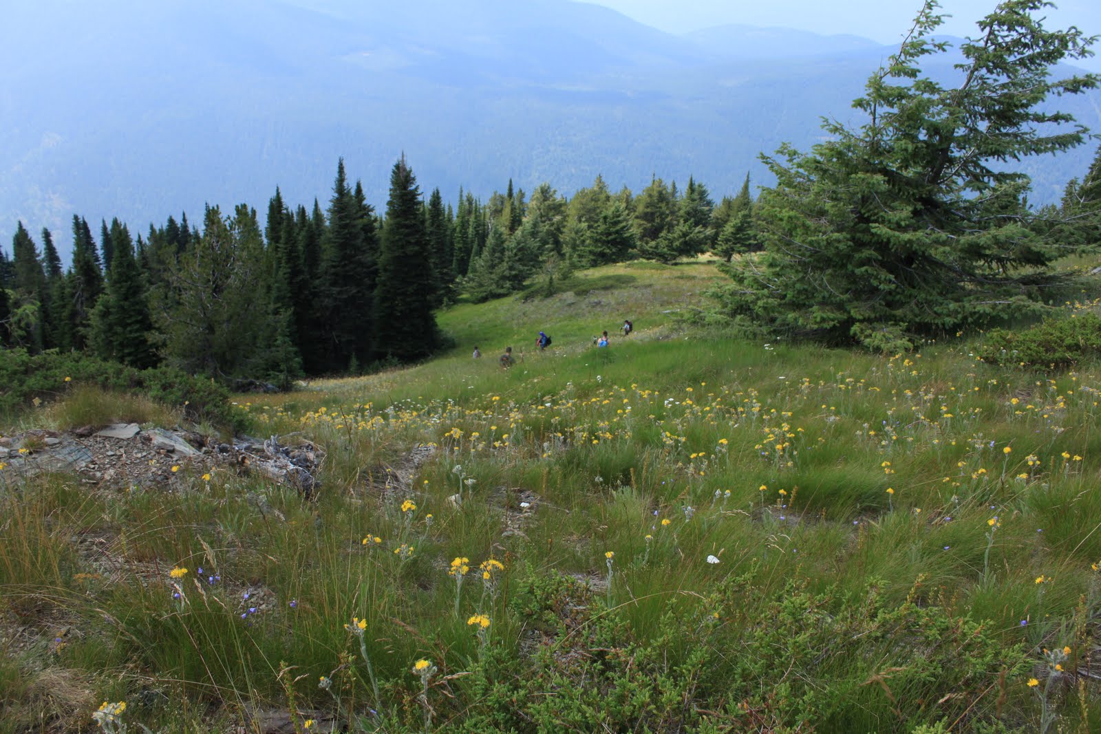
At Little Snowy Top Lookout
View from the summit of Little Snowy Top--normally one can see Snowy Top (BIG Snowy Top!), Canada, and the Idaho Selkirks from this spot.  Today--clouds & more clouds.
The group on the Shedroof Divide Trail
Lorna had a Monet umbrella.  :)
Group picture at the end trailhead.

The wildflowers were fantastic, and I found myself walking well behind the rest of the group on the Divide as I took pictures. 

It was a cold, wet hike, but well worth it!  Maybe I'll try it again later in the month so that I can get pictures of the mountains, too!  :)
My WTA trip report can be found here.

Today's mileage = 21.5 miles
Grand total for the month =113.12 miles

Saturday, August 7, 2010

Today I led a group hike up Hall Mountain from the Noisy Creek Trailhead. 

This trail has been my nemesis for years--today was only my second time on the top despite starting the hike eight or nine times over the past ten years or so.  Fortunately, none of the problems from earlier trips happened on this one!  The summit is spectacular, especially right now with all of the wildflowers in full bloom. 
One of my favorite things about this trail--a strong hiker can walk to the Inland Temperate Rainforest from here, but on Hall Mountain one can find sagebrush growing among all of the wildflowers.
Sullivan Lake far below
Hikers making the switchback

Trails = Noisy Creek #588, 5.3 miles each way + Hall Mountain #540, 1.8 miles each way.
Read my WTA trip report here.
Today's mileage = 14.2 miles
Grand total for the month = 91.62 miles

Friday, August 6, 2010

I have a map of the Salmo Priest Wilderness, and I keep track of all the trails I have hiked within the wilderness by highlighting the trails as I complete them.  At this point there are only a few trails that are not highlighted, and today I added one more trail to my list of completed hikes in this area.  The trail I needed and the starting point for today's hike was the Slate Creek Trail (#525).  It is 4.2 miles long and intersects the North Fork Trail (#507) which leads up to Crowell Ridge in 2.7 miles (Crowell Ridge #515).  I nearly made it to the end of Crowell Ridge (3.7 to Bear Pasture or 2.2 to the end of the ridge), but I reached my turnaround time just 1/2 mile shy of the end of the ridge before it drops down to Bear Pasture.  I was considering hiking a little longer when I started to hear thunder in the distance--that made my decision for me!  The rain caught me in the last four miles of the hike and I walked out in rain, lightening and thunder.  It was a little scary, and I wasn't able to hike as fast as I would have liked because of the downfall on the trail.  The good news is that there are no downed trees on the North Fork Trail--I helped with a trail clearing crew on that trail during Hike-a-Thon last year, so it was nice to see that the trail is still clear.  Now I want to see if I can get some friends to help clear the Slate Creek Trail, too.
Salmo Priest Wilderness!  My FAVORITE place!
Crowell Ridge Trail
Abercrombie & Hooknose Mountains as seen from Crowell Ridge
Crowell Ridge
Sullivan Mountain Lookout in the distance--there is a trailhead there, but it is a very rough road to get to it!
Wildlife!

Read my WTA trip report here.

Today's mileage = 17.2 miles
Grand total for the month = 77.42 miles

Thursday, August 5, 2010

This was the weekend for the Mountaineers' summer outing at the Noisy Creek campground on Sullivan Lake.  I made plans to leave town on Thursday so I could get in some extra miles before the group hikes I planned to lead on Saturday and Sunday.  I got a late start, so I didn't have time to get in the mileage I had originally planned for today.  I wanted to hike in the Little Pend O'Reille Wildlife Refuge; I'll have to save that one for a later date.  Instead I drove directly to Sullivan Lake and hiked the Elk Creek Falls Trail (#560), the Mill Pond Trail (#550), and the Mill Pond Flume Trail (#520).
Elk Creek Falls
Indian Pipes
Today's mileage = 3.36 miles
Grand total for the month = 60.22 miles